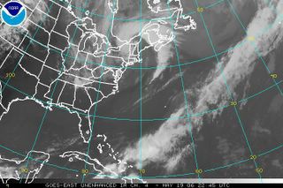
Friday, May 19, 2006
Previous Posts
- Doppler Radar image taken this evening, near the h...
- Surface chart composed this afternoon, depicting t...
- Today Highlights
- Weather Report For Johnson Settlement NB, Recorded...
- New York warned to prepare for hurricanes, cat 2 o...
- RE-ANALYZE OF THE WEATHER CONDITIONS DURING THE WR...
- WARMEST APRIL ON RECORD IN U.S; Drought Persists A...
- Weather Summary For 05/18/2006
- Weather Report For Johnson Settlement NB, Recorded...
- Yesterday Highlights


0 Comments:
Post a Comment
<< Home