Thursday, April 06, 2006


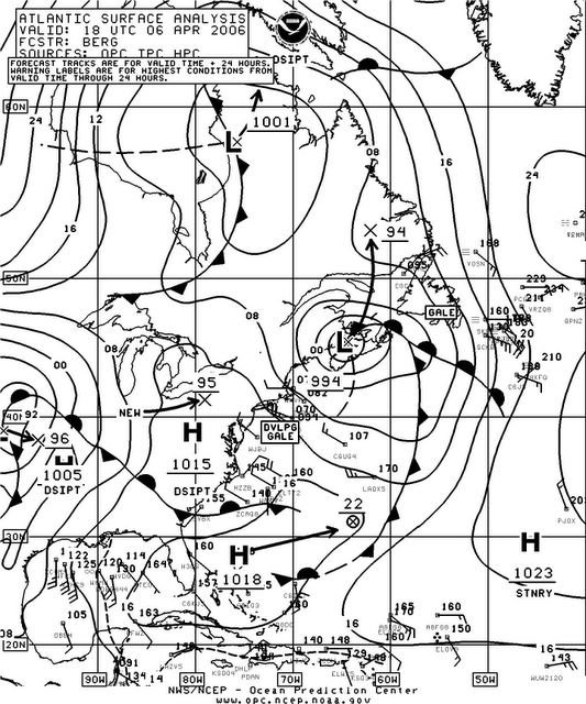
Surface chart depicting the small Nor'Easter type system centered over Western Nova Scotia near maximum pressure depth. Posted by Picasa

Visible Satellite image of North America. Note the tightly coiled center of the small Nor'Easter type storm centered over SW Nova Scotia early this afternoon. Posted by Picasa

New England Doppler Radar Image showing the snow over the area early this afternoon. Posted by Picasa

Second pic showing the more than four inches of wet snow the Region received overnight and this morning. Note it's weight effecting the small pine tree in the center of this pic. Posted by Picasa

First pic showing the more than four inches of wet snow the Region received overnight and this morning. Posted by Picasa

Weather Report For Johnson Settlement NB, Recorded At 2100 UCT On 04/06/2006

Temp: Current; 2.9 C/37 F, High; 3.5 C/38 F, Low; -0.6 C/31 F


Hum: 71%


Bar: 1001 mb/29.56 Inches; Rising Rapidly


Sky: Mainly Cloudy; Nimbostratus


Wind: NW: 5 gusting to 10 mph/8 gusting to 16 km/h


Precip: Light rain


Snowfall: (to current time) 11 cm/4.33 Inches of wet snow, in the predawn and morning hours


Total Precip: (to current time) 14 mm/0.55 Inch of wet snow and some rain melted down


Note: None