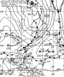
Atlantic Tropical Weather Outlook
000
ABNT20 KNHC 152054
TWOAT
TROPICAL WEATHER OUTLOOK
NWS TPC/NATIONAL HURRICANE CENTER MIAMI FL
530 PM EDT TUE AUG 15 2006
FOR THE NORTH ATLANTIC...CARIBBEAN SEA AND THE GULF OF MEXICO...
A SURFACE LOW PRESSURE SYSTEM LOCATED A FEW HUNDRED MILES SOUTHEAST
OF THE SOUTH AND NORTH CAROLINA COASTS HAS CHANGED LITTLE IN
ORGANIZATION THIS AFTERNOON. WHILE SHOWER AND THUNDERSTORM
ACTIVITY REMAINS MINIMAL AT THIS TIME...ENVIRONMENTAL CONDITIONS
MAY BECOME A LITTLE MORE FAVORABLE FOR A TROPICAL DEPRESSION TO
FORM OVER THE NEXT COUPLE OF DAYS AS THE SYSTEM MOVES SLOWLY
NORTHWARD. AN AIR FORCE RESERVE RECONNAISSANCE AIRCRAFT IS
SCHEDULED TO INVESTIGATE THE SYSTEM ON WEDNESDAY...IF NECESSARY.


