First Seasonal Snowfall Possible In Western Maine Update One


posted by Advackia at 8:34 PM
0 comments
![]()
![]()
posted by Advackia at 8:34 PM
0 comments
![]()
![]()


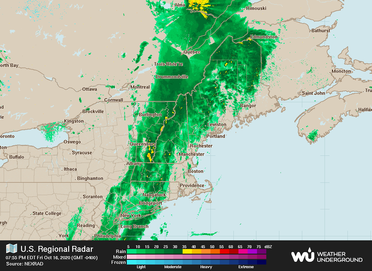
National Weather Service Caribou ME
354 PM EDT Fri Oct 16 2020
MEZ001>006-010-011-015>017-029>032-171000-
Northwest Aroostook-Northeast Aroostook-Northern Somerset-
Northern Piscataquis-Northern Penobscot-Southeast Aroostook-
Central Piscataquis-Central Penobscot-Southern Penobscot-
Interior Hancock-Central Washington-Coastal Hancock-
Coastal Washington-Southern Piscataquis-Northern Washington-
Including the cities of Allagash, Clayton Lake, Madawaska,
Fort Kent, Frenchville, Presque Isle, Caribou, Van Buren,
Mars Hill, Baker Lake, Billy-Jack Depot, Baxter St Park,
Chamberlain Lake, Churchill Dam, Mount Katahdin, Millinocket,
East Millinocket, Patten, Medway, Houlton, Hodgdon, Sherman,
Smyrna Mills, Greenville, Monson, Blanchard, Lincoln, Howland,
Springfield, Bangor, Brewer, Orono, Old Town, Amherst, Aurora,
Dedham, Eastbrook, Great Pond, Calais, Grand Lake Stream, Wesley,
Princeton, Ellsworth, Bar Harbor, Bucksport, Orland, Castine,
Eastport, Perry, Machias, Cherryfield, Dover-Foxcroft, Milo,
Guilford, Danforth, Vanceboro, and Topsfield
354 PM EDT Fri Oct 16 2020
...Heavy Rain Expected Across Most of Northern and Eastern Maine
through Saturday with Heaviest Rain Totals over the Central Maine
Highlands...
...Rain Changing to Wet Snowfall Mostly over High Terrain across
Northwest and Central Highlands of Maine Late Morning into
Afternoon...
Rainfall totals with this current rain event will range from
about 0.75 inches across Washington County upwards to 2.5 to 3.0
equivalent inches over the northwest and central Maine highlands
(where moderate to heavy rain banding will linger the longest) by
Saturday evening. Hunters and campers should be alert for high
stream flows and even possible minor stream flooding by Saturday
afternoon especially over the northwest and central highlands.
In addition to heavy rainfall, colder air on brisk northwest winds
wrapping in behind developing low pressure tracking over southeast
Maine will result in a change over to wet snow over the northwest
and central highlands beginning as early as mid Saturday morning
at higher terrain near the Quebec border, and by early to mid
Saturday afternoon over the central highlands and higher terrain
of north central Aroostook. One to three inches of very wet
snowfall is possible at and above 1200 feet MSL, with even higher
snow totals possible over high mountain summits (refer to the
recreation forecast under PWMRECCAR for details) by Saturday
evening.
Those wanting to brave the elements overnight through Saturday
will need clothing and camping equipment to deal with heavy
rainfall, falling temperatures with brisk winds, and possibly
even mountain snowfall.
$$
VJN
3:47 PM ADT Friday 16 October 2020
Rainfall warning in effect for:
western half of Restigouche County
Rain, at times heavy, is expected.
Heavy rain expected this weekend.
When: continuing tonight and Saturday, tapering off before morning on Sunday.
Where: northwestern New Brunswick.
Rainfall amounts: 50 millimetres or more.
Remarks: Heavy rain associated with an approaching low pressure system could give rainfall amounts of 50 millimetres or more over parts of New Brunswick this weekend. Rain will intensify overnight, becoming heavy at times on Saturday and ending overnight Saturday night.
Additionally, there is likely to be some wet snow mixing with the rain over higher terrain Saturday night.
Localized flooding in low-lying areas is possible. Be prepared for possible winter conditions at higher elevations.
Rainfall warnings are issued when significant rainfall is expected.
Please continue to monitor alerts and forecasts issued by Environment Canada. To report severe weather, send an email to NBstorm@canada.ca or tweet reports using #NBStorm.
posted by Advackia at 2:47 PM
0 comments
![]()
![]()
